|
|
 |
The Yukon
The Land
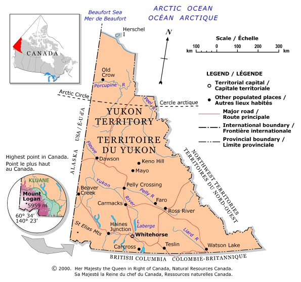
The Yukon Territory in Canada's northwest covers 483 450 km2. The
perimeters of this mountainous territory form a rough triangle bordered on the
south by British Columbia, on the west by the U.S. state of Alaska and on the
east by the Northwest Territories. The northern tip of the triangle meets the
chilly waters of the Beaufort Sea. Mount Logan, Canada's highest peak at 6050 m,
is located in southwestern Yukon.
The Yukon can be divided into two broad geographical regions: taiga and tundra. Taiga is the boreal forest belt that circles the world in the subarctic zone, including most of the Yukon. Tundra is the vast, rocky plain in the Arctic regions, where the extreme climate has stunted vegetation.
The Yukon has a subarctic climate. The high altitude of much of the territory and the semi-arid climate provide relatively warm summers with temperatures frequently reaching 25oC or more during the long summer days. In winter the temperature ranges between +4 and -50oC in the south and slightly colder farther north.
Above the Arctic Circle (latitude 66o north), the Yukon is known as "the land of the midnight sun" because for three months in summer, sunlight is almost continuous. In winter, however, darkness sets in, and the light of day is not seen for a quarter of the year.
![]()